


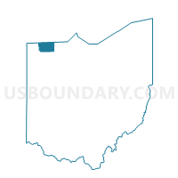
FRANKLIN, Fulton County, Ohio
About
Outline

Summary
| Unique Area Identifier | 646580 |
| Name | FRANKLIN |
| County | Fulton County |
| State | Ohio |
| Area (square miles) | 28.75 |
| Land Area (square miles) | 28.65 |
| Water Area (square miles) | 0.10 |
| % of Land Area | 99.66 |
| % of Water Area | 0.34 |
| Latitude of the Internal Point | 41.61092430 |
| Longtitude of the Internal Point | -84.31218450 |
Maps


Graphs
Select a template below for downloading or customizing gragh for FRANKLIN, Fulton County, Ohio


Neighbors
Neighoring Voting District (by Name) Neighboring Voting District on the Map
- CHESTERFIELD, Fulton County, OH
- DOVER, Fulton County, OH
- GERMAN, Fulton County, OH
- GORHAM, Fulton County, OH
- PETTISVILLE, Fulton County, OH
- PRECINCT BRADY, Williams County, OH
- PRECINCT MILLCREEK, Williams County, OH
Top 10 Neighboring County Subdivision (by Population) Neighboring County Subdivision on the Map
- Clinton township, Fulton County, OH (9,554)
- German township, Fulton County, OH (6,443)
- Brady township, Williams County, OH (2,602)
- Gorham township, Fulton County, OH (2,260)
- Dover township, Fulton County, OH (1,578)
- Chesterfield township, Fulton County, OH (1,012)
- Mill Creek township, Williams County, OH (802)
- Franklin township, Fulton County, OH (743)
Top 10 Neighboring Unified School District (by Population) Neighboring Unified School District on the Map
- Wauseon Exempted Village School District, OH (10,371)
- Evergreen Local School District, OH (7,578)
- Archbold Area Local School District, OH (7,238)
- Millcreek-West Unity Local School District, OH (3,675)
- Fayette Local School District, OH (2,599)
- Pettisville Local School District, OH (2,057)
Top 10 Neighboring State Legislative District Lower Chamber (by Population) Neighboring State Legislative District Lower Chamber on the Map
Top 10 Neighboring State Legislative District Upper Chamber (by Population) Neighboring State Legislative District Upper Chamber on the Map
Top 10 Neighboring 111th Congressional District (by Population) Neighboring 111th Congressional District on the Map
Top 10 Neighboring Census Tract (by Population) Neighboring Census Tract on the Map
- Census Tract 408, Fulton County, OH (4,940)
- Census Tract 9501, Williams County, OH (4,796)
- Census Tract 9504, Williams County, OH (4,657)
- Census Tract 406, Fulton County, OH (4,430)